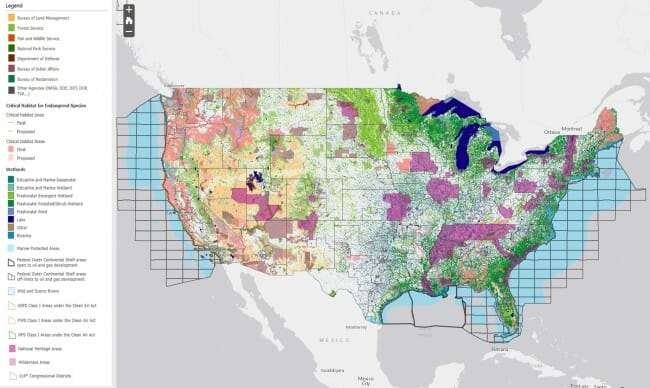
Federal Lands Footprint
Courtesy of the House Committee on Natural Resources comes this map of Federal "footprint", land either owned by the Feds or under some sort of Federal designation that has substantial impacts on property use.
You can click the map to enlarge it or else just go to the map with layers here. Click the details button in the upper left to see the legend. Beware, the map is pretty slow to function for me. You might find an alternative that works better here. You won't find a lot of private land west of Denver.
For much of the 19th century, the US had a sensible land policy that promoted homesteading and outright private purchases of Federal land. Then this policy stopped, and what we have now is most of the land west of Denver managed by special interests who will fight tooth and nail to keep the land out of private hands and in their own control.

Most of the land is not even used for anything, and thus decreases national wealth. The feds have been cutting back on grazing permits and mining leases (and now no new coal leases allowed) and slowing the process for oil permits. Timber cutting on federal land is now 20% of its peak.